Urban Centres and Localities

Latest release
Australian Statistical Geography Standard (ASGS) Edition 3
Reference period
July 2021 - June 2026

Urban Centres and Localities (UCLs) represent areas of concentrated urban development. They are identified using dwelling and population density criteria and data from the 2021 Census of Population and Housing. 

Urban Centres and Localities are designed to facilitate the visualisation and analysis of statistical data, in particular data from the Census of Population and Housing. The criteria for inclusion (such as minimum population sizes) enable users to access cross classified Census data (such as population counts by various age ranges), without limiting the usability of the associated data. 

The ABS does not produce an official list of towns and cities in Australia. Please refer to state and territory lists of gazetted localities for this information. Urban Centres and Localities are not an official definition of towns and cities for several reasons. Firstly, small towns that do not meet the minimum population criteria are allocated to Remainder of State/Territory in this classification. Additionally, urban settlements near each other may be combined under one name. For example, several towns are grouped together in the Urban Centre of Central Coast. Towns and cities not included in Urban Centres and Localities may be represented by other geographies such as Statistical Areas Level 2 or approximated Suburbs and Localities.

UCL design criteria

Urban Centres and Localities (UCLs) are defined using Statistical Areas Level 1 (SA1s) that meet density and/or urban infrastructure criteria.

Areas not within Urban Centres or Localities are labelled as Remainder of State/Territory and considered to be rural for the purpose of statistical analysis. In combination with Remainder of State/Territory areas, Urban Centres and Localities cover the whole of Australia without gaps or overlaps.

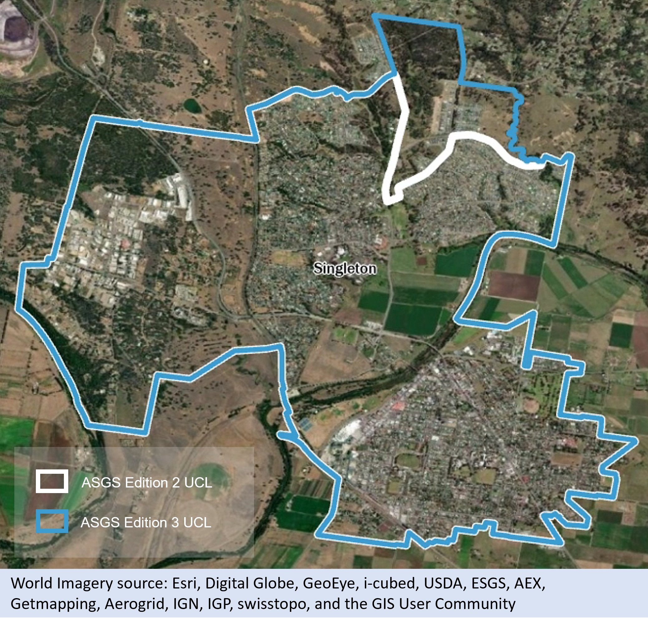
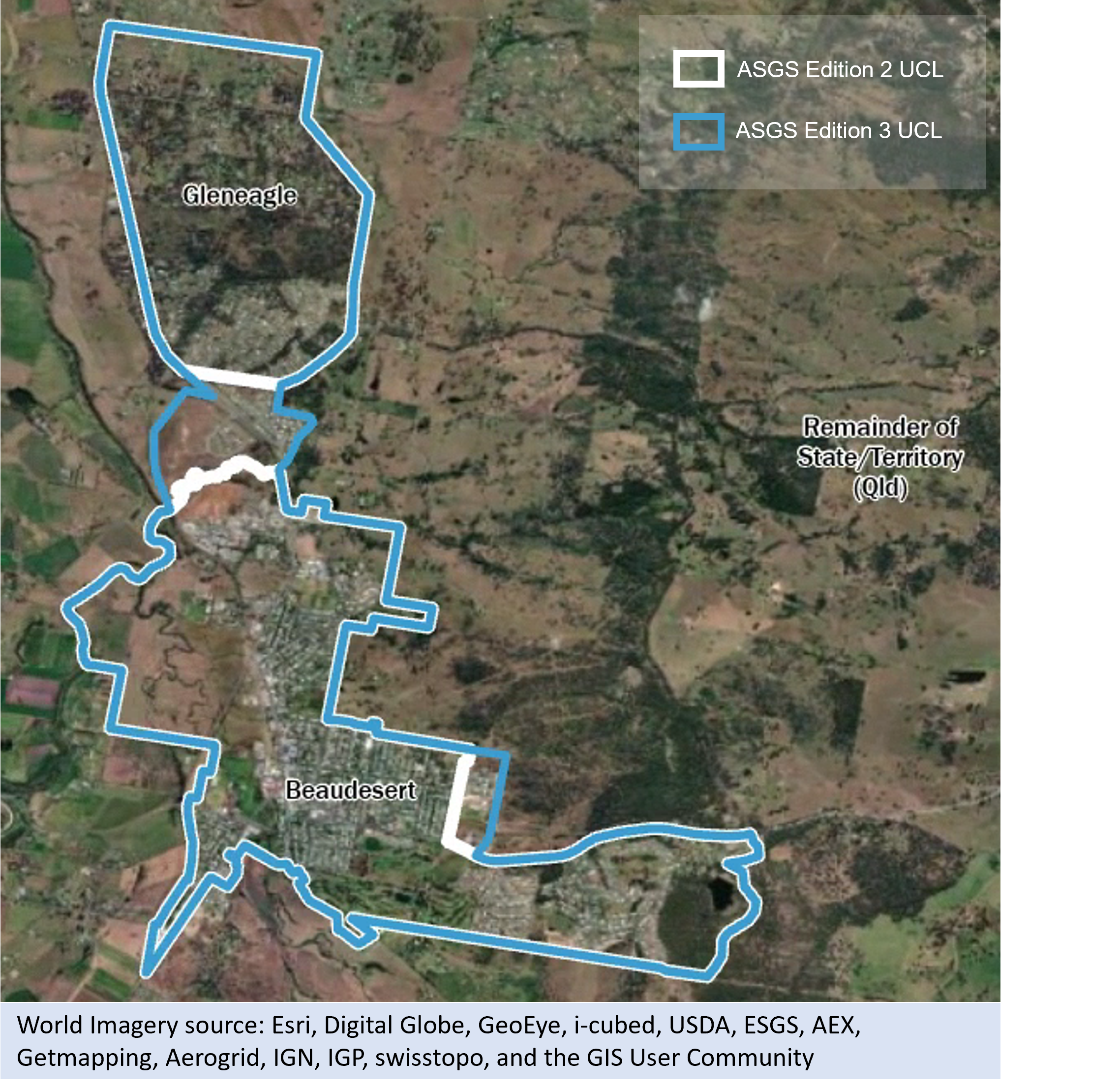
Where urban areas cross state or territory boundaries, Urban Centres are split into two parts so that they can be aggregated up to the state or territory level. However, cross border Urban Centres are considered to be one unit for design purposes – for example, Albury - Wodonga.

Defining urban Statistical Areas Level 1

Population and dwelling density criteria

Statistical Areas Level 1 (SA1s) are considered urban if they meet one or more of the following criteria:

  • The SA1 has an urban Mesh Block* population greater than or equal to 45% of the total SA1 population^ and a dwelling density greater than or equal to 45 dwellings per square (sq) kilometre (km).
  • The SA1 has a population density greater than or equal to 100 persons per sq km and a dwelling density greater than or equal to 50 dwellings per sq km.
  • The SA1 has a population density greater than or equal to 200 persons per sq km.

*An urban Mesh Block is defined as a Mesh Block with a population density of 200 persons or more per sq km.
^The population and dwelling figures used for these criteria are Place of Usual Residence from the 2021 Census of Population and Housing.
 

Urban infrastructure criteria

SA1s may also be considered urban if they are adjacent to another SA1 that meets the population and dwelling density criteria and also contain substantial urban infrastructure or land use, as defined below.

Note that SA1s meeting at a point are not considered to be adjacent.

Urban infrastructure

The following infrastructure and land use types are considered to be of urban character if adjacent to an urban SA1 as described above:

  • airports with paved runways
  • caravan parks
  • cemeteries
  • community parks and reserves
  • defence facilities
  • educational institutions
  • electricity sub stations
  • golf courses
  • grain storage
  • hospitals
  • industrial areas (including meat works and abattoirs)
  • non-agricultural commercial development
  • office complexes
  • parks, reserve areas, foreshore reserves that are between an urban area and the shoreline
  • ports and port facilities
  • prisons
  • racecourses
  • railway stations, bus stations and similar transport hubs
  • research facilities
  • sale yards
  • sewerage facilities
  • shopping centres
  • show grounds
  • sports facilities
  • tourist attractions (including theme parks)
  • tourist resorts
  • unpaved airstrips immediately adjacent to the built-up area
  • waste disposal facilities

Not urban infrastructure

The following infrastructure and land use types are not considered urban, unless completely surrounded by urban SA1s:

  • mines
  • wineries
  • power stations
  • dams and reservoirs
  • national parks
  • forests
  • shooting ranges
  • explosives handling and munitions areas
  • defence force training grounds

Urban Centre criteria

Adjacent urban SA1s are combined to form Urban Centres if they meet the following requirements:

  • The aggregated population of urban SA1s is 1,000 persons or more
  • The combined urban SA1s have an urban identity, meaning shared urban facilities of some kind and an identifiable name

Discrete Aboriginal and Torres Strait Islander communities and discrete tourist resorts with a population exceeding 1,000 are considered to be Urban Centres regardless of density.

A military base or prison cannot be an Urban Centre in its own right.

State or territory borders, Local Government Areas (LGA) and other administrative boundaries are not considered in determining whether an SA1 should be included within the Urban Centre.

Non-urban SA1s may be included in an Urban Centre for three reasons.

  1. An SA1 is completely surrounded by urban SA1s belonging to the same Urban Centre. This includes areas that are bounded by an Urban Centre and a shore or coastline.
  2. An SA1 is acting as a bridge between an Urban Centre and a nearby urban SA1 that is within 500 metres road distance and could reasonably be regarded as part of that Urban Centre.
  3. An SA1 is on the edge of an Urban Centre and contains high density development, or urban infrastructure as well as rural land.

In each of these cases, discretion is applied when factoring in the overall design of the Urban Centre, especially the effect the inclusion of the non-urban SA1 will have on the overall population density of that Urban Centre. In rare instances, discretion may also be applied to other Urban Centre criteria to maintain stability over time.

Both SA1s and Mesh Blocks are designed to reflect the edge of urban areas. However, there are some cases where the other design criteria for these areas, such as population size or alignment to gazetted Suburb and Locality boundaries, may compromise this. As a result some SA1s may contain urban settlement or infrastructure but not meet the urban SA1 criteria.

Urban Centres with a population of 20,000 people or more are combined with any other Urban Centre within 3km. This distance is calculated along sealed roads between the edge of the closest urban Mesh Blocks, or adjoining urban infrastructure and land use, within each Urban Centre. SA1s containing the shortest road route between the two clusters are also included to bridge them together, unless they severely compromise Urban Centre design. Ferry and rail links are not considered.

Adjacent Urban Centres are not combined and are considered separate if:

  • they are separated by an un-bridged geographical barrier, such as a river, escarpment, inlet, lake or swamp
  • the Urban Centres represent separate labour markets (defined as: a single GCCSA or the combined SA4s of Newcastle and Lake Macquarie and Hunter Valley exc Newcastle, as these represent a single labour market)


Locality criteria

Localities represent smaller discrete settlements with populations generally between 200 and 999 people.  Localities are diverse, reflecting many different configurations of small settlements, including villages, towns, clusters of peri-urban style development, and areas with significant seasonal tourism.

One or more adjacent urban SA1s are combined to form Localities if they meet the following requirements:

  • The aggregated population of urban SA1s is between 200 and 999 persons.
  • The combined urban SA1s have some shared urban identity, though urban facilities are not essential.


A Locality may contain a population exceeding 999 persons if it contains an urban SA1 that does not meet all the criteria for an Urban Centre (see above). These are referred to as large localities.

In Localities with high seasonal tourist numbers, the population criterion may be applied to the enumerated, rather than usual resident population to more appropriately represent the area’s urban development. For example, ski resorts. 


Additional criteria for Localities are:

  • A Locality is combined with an adjacent Urban Centre or Locality unless they are functionally a separate entity.
  • A military base, prison or retirement community cannot be a Locality in its own right.
  • A Locality cannot cross state or territory boundaries.
     

Where an existing Locality no longer meets the criteria above, it may be removed from the classification. This is because meaningful data cannot be produced for areas with less than 200 persons (for example cross classified Census counts of population groups by age ranges) and to maintain accurate comparisons of urban areas over time. That said, several measures are used to maintain Locality status wherever possible. This is done to avoid the situation where Localities are brought in and out of the classification from one edition to another, creating unnecessary instability in areas where change may be temporary. A Locality may remain in the classification if:

  • its population drops below 200 for the first time, but remains above 180 or,
  • it meets the population threshold but not the urban SA1 criteria, but does contain an urban Mesh Block and has an overall population density of 30 persons per square kilometre or over, or
  • it represents an Aboriginal or Torres Strait Islander community, or
  • extenuating circumstances, such as natural disasters, have caused a temporary drop in population that is unlikely to persist.

If a Locality does not meet any of these measures, it is removed from the classification.

Remainder of State/Territory

All SA1s in a state or territory which are not included in a UCL, are combined into Remainder of State/Territory. Special purpose SA1s (Migratory – Offshore – Shipping and No usual address) are identified separately.

UCL name criteria

The key criteria for Urban Centre and Locality (UCL) names are that they be:

  • meaningful
  • have a maximum of 50 characters
  • unique, i.e. not shared by any other UCL in Australia


Where a UCL represents a single dominant centre then it is named for that centre, for example:

  • Melbourne
  • Sydney
  • Townsville


Where a UCL represents a combination of two centres of comparable importance, it is named for both centres separated by a hyphen, with the most populated centre taking precedence, for example:

  • Shepparton – Mooroopna
  • Bushfield - Woodford (L)
  • Berrara - Cudmirrah (L)


Where a UCL crosses a state or territory border, the component parts are identified in brackets, for example:

  • Gold Coast - Tweed Heads (Gold Coast Part)
  • Gold Coast - Tweed Heads (Tweed Heads Part)
  • Canberra - Queanbeyan (Canberra Part)
  • Canberra - Queanbeyan (Queanbeyan Part)


Where a UCL represents a region with a widely recognised name, then that name is used, for example:

  • Sunshine Coast
  • Central Coast


Urban Centre and Locality names are unique within Australia. If there are two Urban Centres with the same name, the standard state or territory abbreviation is added in brackets, for example:

  • Maitland (SA)
  • Maitland (NSW)
  • Mount Barker (SA)
  • Mount Barker (WA)
  • Richmond (L) (Tas.)
  • Richmond (L) (Qld)
  • Lismore (NSW)
  • Lismore (L) (Vic.)


Localities have (L) appended to their names, for example:

  • Agnes Bank (L)
  • Beachport (L)
  • Mount Burr (L)


In some cases, Gazetted Localities and Aboriginal and Torres Strait Islander community names have been used to create UCL names.

UCL coding structure

Urban Centres and Localities (UCL) are identifiable by 6-digit hierarchical codes. This is built from State/Territory (S/T), Section of State (SOS), Section of State Range (SOSR) and UCL identifiers. A UCL identifier is only unique if it is preceded by the state or territory, Section Of State and Section Of State Range identifiers. It is therefore possible to identify the population range to which the UCL belongs from the Section of State and Section of State Range codes.

UCL coding structure examples
S/TSOSSOSRUCLUCL Name
922002Jervis Bay (L)
631001Remainder of State/Territory (Tas.)


Non-spatial special purpose codes are also part of the Urban Centres and Localities classification.

  • 997 is reserved for cases where people are coded to Migratory – Offshore – Shipping Statistical Areas Level 1.
  • 994 is reserved for cases where people are coded to No usual address Statistical Areas level 1.
  • ZZZ is reserved for cases where people are coded to Outside Australia.
Coding structure examples for UCL special purpose codes
S/TSOSSOSRUCLUCL Name
179997Migratory - Offshore - Shipping (NSW)
299994No usual address (Vic.)


An additional special purpose code for Outside Australia is also included in the classification, consistent with all other ASGS Edition 3 geographies. The code for Outside Australia is ZZZZZZ.

UCL changes

Urban areas and their populations are dynamic; they can grow, absorb nearby centres or decline. Consequently, Urban Centres and Localities (UCLs) also need to change so that they continue to provide an effective statistical representation of urban areas.

Some examples of UCL change are described below.

Boundary changes

Urban Centres and Localities usually experience boundary changes as a result of population growth or decline. The image below shows an example of this for the Urban Centre of Singleton.

Singleton UCL urban growth over time

Picture showing aerial satellite imagery of Singleton in New South Wales. Image shows the Singleton UCL boundary for Edition 2 (2016) in white, and for Edition 3 (2016) in blue.
This figure shows aerial imagery of Singleton, New South Wales. The white boundary overlaid shows the Edition 2 (2016) Singleton UCL while the Edition 3 (2021) boundary is shown in blue. In the north east corner urban development has extended past the Edition 2 boundary, but is included within the Edition 3 boundary. World imagery source: Esri, Digital Globe, GeoEye, i-cubed, USDA, USGS, AEX, Getmapping, Aerogrid, IGN, IGP, swisstopo, and the GIS User Community.

Conversely, some Urban Centres and Localities can decrease in size due to either population decline or more commonly, changes to Statistical Area Level 1 design. As part of the review of Statistical Areas Level 1 for ASGS Edition 3, improving Urban Centre and Locality design was considered in some areas. As a result, some Urban Centres and Localities now have a smaller, but more accurate boundary that defines their urban footprint, for example Kingaroy shown below. The rural areas in the northeast and northwest of the town were removed in Edition 3 due to SA1 design more effectively separating rural and urban areas.

Kingaroy UCL change over time

Picture showing aerial satellite imagery of Kingaroy in Queensland. Image shows the Kingaroy UCL boundary for Edition 2 (2016) in white, and for Edition 3 (2016) in blue.
This figure shows aerial imagery of Kingaroy, Queensland. The white boundary overlaid shows the Edition 2 (2016) Kingaroy UCL while the Edition 3 (2021) boundary is shown in blue. Large areas of non urban land use are included within the Edition 2 boundary due to SA1 design. These areas have been removed in Edition 3. World imagery source: Esri, Digital Globe, GeoEye, i-cubed, USDA, USGS, AEX, Getmapping, Aerogrid, IGN, IGP, swisstopo, and the GIS User Community.

In a small number of situations urban development can occur in ways not closely defined by Statistical Areas Level 1. This can result in small areas of urban settlement being left out of the UCL or parts of non-urban land being included in the UCL. In Edition 3, the majority of these cases were resolved, with the exception of 313003 Dalby, pictured below. To ensure that all of the urban population is included within the Dalby Urban Centre, a significant area of non-urban land has also been included resulting in a boundary much larger than the actual urban extent. Users should use the adjusted area for Dalby which is supplied in the UCL association Edition 2 (2016) to Edition 3 (2021) file available for download. The adjusted area has been calculated by approximating the urban extent with 2021 Mesh Blocks.


Dalby UCL in Edition 3 (2021)

Picture showing aerial satellite imagery of Dalby. Image shows the Edition 3 (2021) Dalby UCL boundary in blue.
This figure shows aerial imagery of Dalby, Queensland. The blue boundary overlaid shows the Edition 3 (2021) Dalby UCL. This UCL boundary includes large areas of non urban land use as a result of SA1 design. World imagery source: Esri, Digital Globe, GeoEye, i-cubed, USDA, USGS, AEX, Getmapping, Aerogrid, IGN, IGP, swisstopo, and the GIS User Community.

Amalgamations

As Urban Centres and Localities increase in size, the distance between settlements can decrease to the point where they are seen as a single urban settlement. Where this occurs, they can be amalgamated and defined by a single Urban Centre or Locality. Additionally, Urban Centres and Localities may be merged into large Urban Centres (over 20,000 people) when they are within 3km road distance of each other. For example, Gleneagle and Beaudesert have expanded towards each other since Edition 2 (2016) and have been amalgamated in Edition 3 (2021).

Amalgamation of Beaudesert and Gleneagle UCLs

Picture showing aerial satellite imagery of Beaudesert and Gleneagle in Queensland. Image shows the Edition 2 (2016) Beaudesert and Gleneagle UCLs boundary in white, and for Edition 3 (2016) in blue.
This figure shows aerial imagery of Beaudesert and Gleneagle, Queensland. The white boundary overlaid shows the Edition 2 (2016) Beaudesert and Gleneagle UCLs while the Edition 3 (2021) boundary for Beaudesert UCL is shown in blue. Urban growth between the two UCLs has resulted in amalgamation in Edition 3. World imagery source: Esri, Digital Globe, GeoEye, i-cubed, USDA, USGS, AEX, Getmapping, Aerogrid, IGN, IGP, swisstopo, and the GIS User Community.

Understanding changes

This publication includes the Edition 2 (2016) to Edition 3 (2021) UCL association file which can be downloaded from the allocation file page. This helps users understand changes between UCL Editions and facilitates statistical comparisons over multiple Censuses. This table includes information on the area of the UCLs as well as the type of change that occurred. Change labels are as follows:

  • Amalgamated – When UCLs have been merged to form one UCL.
  • Name Change – When a UCL has changed name. This includes the addition or removal of the (L) at the end of a name to symbolise if a UCL has changed status from Locality to Urban Centre and vice-versa.
  • New – When a UCL is new for Edition 3.
  • Removed – When a UCL no longer meets the criteria and is removed from the UCL structure.


ABS Maps is an online mapping tool that allows users to visualise and understand differences between Australian Statistical Geography Standard (ASGS) Edition 2 (2016) and Edition 3 (2021) UCLs. This can be used in conjunction with the association file to understand the nature of UCL boundary changes.

Back to top of the page