Image
Description
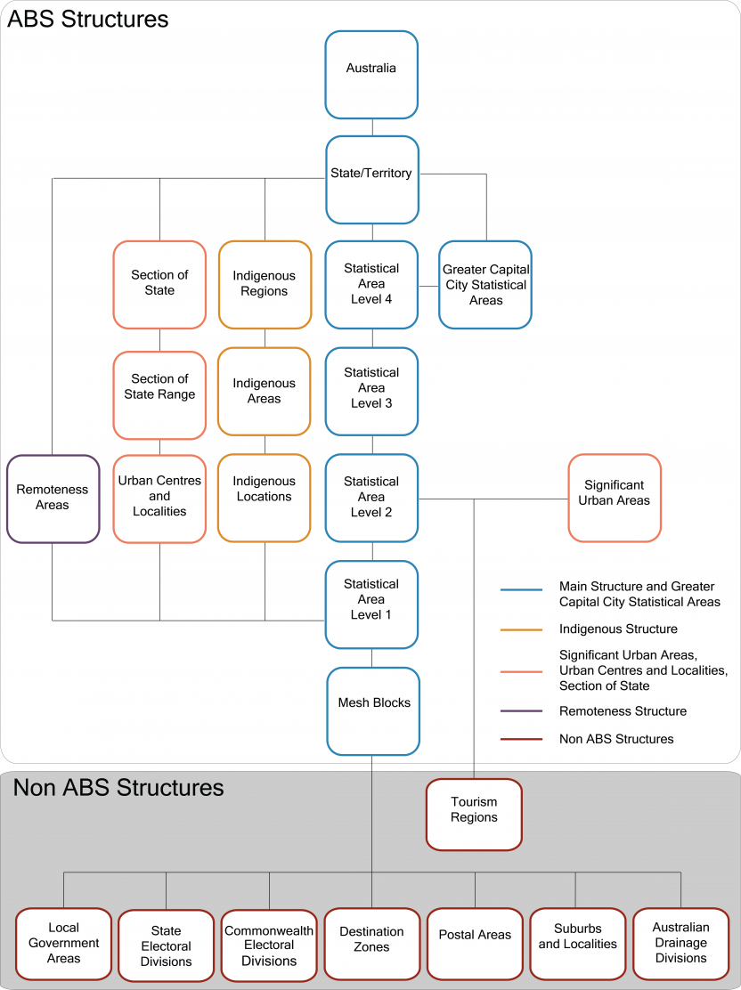
The diagram shows how different elements of the ASGS are related.
The main building blocks of the ASGS are Mesh Blocks. Mesh Blocks build to SA1s which aggregate up to SA2s and so on in the following order from smallest to largest areas: Mesh Blocks, SA1s, SA2s, SA3s, SA4s, State/Territories and Australia. Greater Capital City Statistical Areas are published as part of the Main Structure and are built up from SA4s.
The smallest units of the Indigenous Structure, Indigenous Locations are built up from SA1s. Indigenous Locations aggregate up to Indigenous Areas and Indigenous Areas then aggregate up to Indigenous Regions.
Most Non ABS Structures are built up from Mesh Blocks. This includes Postal Areas, Suburbs and Localities, Local Government Areas, State Electoral Divisions, Commonwealth Electoral Divisions, Australian Drainage Divisions and Destination Zones. Tourism Regions are the exception and are built up from SA2s.
Urban Centres and Localities (UCLs) are built from SA1s. The population contained within each UCL then determines which Section of State Region and Section of State each UCL is allocated to. Significant Urban Areas are built from SA2s and are designed to capture larger towns and cities.
Remoteness Areas are built up from SA1s.
Further detail on how both the ABS Structures and Non ABS Structures are designed is available in the different sections of this publication.