Australian Statistical Geography Standard (ASGS) Edition 3
Date of publication: 20 July 2021
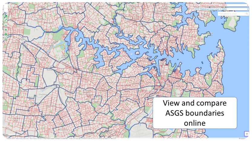
Presentation format: Digital boundaries
Custodian: Australian Bureau of Statistics (ABS)
Description
The Main Structure and Greater Capital City Statistical Areas of ASGS Edition 3 consists of the following regions:
- Mesh Block (MB)
- Statistical Area Level 1 (SA1)
- Statistical Area Level 2 (SA2)
- Statistical Area Level 3 (SA3)
- Statistical Area Level 4 (SA4)
- Greater Capital City Statistical Areas (GCCSA)
- State and Territory (S/T)
- Australia (AUS)
Nomenclature
File names have the format <file type>_<2021>_<AUST>_<GDA> where:
- <file type> represents the type of boundaries in each file
- MB = Mesh Block
- SA1 = Statistical Area Level 1
- SA2 = Statistical Area Level 2
- SA3 = Statistical Area Level 3
- SA4 = Statistical Area Level 4
- GCCSA = Greater Capital City Statistical Area
- STE = State and Territory
- AUS = Australia
- <2021> represents 2021 the year of the Australian Statistical Geography Standard (ASGS) Edition 3
- <AUST> indicates the data covers all of Australia
- <GDA> indicates the Geocentric Datum of Australia used, and may equal GDA94 or GDA2020
Within the files, the States and Territories are identified by unique one-digit codes.
| Code | S/T |
|---|---|
1 | New South Wales |
2 | Victoria |
3 | Queensland |
4 | South Australia |
5 | Western Australia |
6 | Tasmania |
7 | Northern Territory |
8 | Australian Capital Territory |
9 | Other Territories |
File attributes: All tables show file type, file name, field and the data type.
Field length: the attribute field lengths specified below may present differently depending on the type of file and the software used to view tables or boundaries. Data is not truncated or altered in any way by this process.
Geography: Mesh Block (MB)
File names: MB_2021_AUST_GDA94, MB_2021_AUST_GDA2020
| Count | Field (GeoPackage) | Field (ESRI .shp) | Data type | Length of available characters |
|---|---|---|---|---|
1 | MB_CODE_2021 | MB_CODE21 | Character | 11 |
2 | MB_CATEGORY_2021 | MB_CAT21 | Character | 30 |
3 | CHANGE_FLAG_2021 | CHG_FLAG21 | Character | 1 |
4 | CHANGE_LABEL_2021 | CHG_LBL21 | Character | 11 |
5 | SA1_CODE_2021 | SA1_CODE21 | Character | 11 |
6 | SA2_CODE_2021 | SA2_CODE21 | Character | 9 |
7 | SA2_NAME_2021 | SA2_NAME21 | Character | 50 |
8 | SA3_CODE_2021 | SA3_CODE21 | Character | 5 |
9 | SA3_NAME_2021 | SA3_NAME21 | Character | 50 |
10 | SA4_CODE_2021 | SA4_CODE21 | Character | 3 |
11 | SA4_NAME_2021 | SA4_NAME21 | Character | 50 |
12 | GCCSA_CODE_2021 | GCC_CODE21 | Character | 5 |
13 | GCCSA_NAME_2021 | GCC_NAME21 | Character | 50 |
14 | STATE_CODE_2021 | STE_CODE21 | Character | 1 |
15 | STATE_NAME_2021 | STE_NAME21 | Character | 50 |
16 | AUS_CODE_2021 | AUS_CODE21 | Character | 3 |
17 | AUS_NAME_2021 | AUS_NAME21 | Character | 50 |
18 | AREA_ALBERS_SQKM | AREASQKM21 | Double | 25,4 |
19 | ASGS_LOCI_URI_2021 | LOCI_URI21 | Character | 622 |
Geography: Statistical Area Level 1 (SA1)
File names: SA1_2021_AUST_GDA94, SA1_2021_AUST_GDA2020
Count | Field (GeoPackage) | Field (ESRI .shp) | Data type | Length of available characters |
|---|---|---|---|---|
1 | SA1_CODE_2021 | SA1_CODE21 | Character | 11 |
2 | CHANGE_FLAG_2021 | CHG_FLAG21 | Character | 1 |
3 | CHANGE_LABEL_2021 | CHG_LBL21 | Character | 11 |
4 | SA2_CODE_2021 | SA2_CODE21 | Character | 9 |
5 | SA2_NAME_2021 | SA2_NAME21 | Character | 50 |
6 | SA3_CODE_2021 | SA3_CODE21 | Character | 5 |
7 | SA3_NAME_2021 | SA3_NAME21 | Character | 50 |
8 | SA4_CODE_2021 | SA4_CODE21 | Character | 3 |
9 | SA4_NAME_2021 | SA4_NAME21 | Character | 50 |
10 | GCCSA_CODE_2021 | GCC_CODE21 | Character | 5 |
11 | GCCSA_NAME_2021 | GCC_NAME21 | Character | 50 |
12 | STATE_CODE_2021 | STE_CODE21 | Character | 1 |
13 | STATE_NAME_2021 | STE_NAME21 | Character | 50 |
14 | AUS_CODE_2021 | AUS_CODE21 | Character | 3 |
15 | AUS_NAME_2021 | AUS_NAME21 | Character | 50 |
16 | AREA_ALBERS_SQKM | AREASQKM21 | Double | 25,4 |
17 | ASGS_LOCI_URI_2021 | LOCI_URI21 | Character | 622 |
Geography: Statistical Area Level 2 (SA2)
File names: SA2_2021_AUST_GDA94, SA2_2021_AUST_GDA2020
Count | Field (GeoPackage) | Field (ESRI .shp) | Data type | Length of available characters |
|---|---|---|---|---|
1 | SA2_CODE_2021 | SA2_CODE21 | Character | 9 |
2 | SA2_NAME_2021 | SA2_NAME21 | Character | 50 |
3 | CHANGE_FLAG_2021 | CHG_FLAG21 | Character | 1 |
4 | CHANGE_LABEL_2021 | CHG_LBL21 | Character | 11 |
5 | SA3_CODE_2021 | SA3_CODE21 | Character | 5 |
6 | SA3_NAME_2021 | SA3_NAME21 | Character | 50 |
7 | SA4_CODE_2021 | SA4_CODE21 | Character | 3 |
8 | SA4_NAME_2021 | SA4_NAME21 | Character | 50 |
9 | GCCSA_CODE_2021 | GCC_CODE21 | Character | 5 |
10 | GCCSA_NAME_2021 | GCC_NAME21 | Character | 50 |
11 | STATE_CODE_2021 | STE_CODE21 | Character | 1 |
12 | STATE_NAME_2021 | STE_NAME21 | Character | 50 |
13 | AUS_CODE_2021 | AUS_CODE21 | Character | 3 |
14 | AUS_NAME_2021 | AUS_NAME21 | Character | 50 |
15 | AREA_ALBERS_SQKM | AREASQKM21 | Double | 25,4 |
16 | ASGS_LOCI_URI_2021 | LOCI_URI21 | Character | 622 |
Geography: Statistical Area Level 3 (SA3)
File names: SA3_2021_AUST_GDA94, SA3_2021_AUST_GDA2020
Count | Field (GeoPackage) | Field (ESRI .shp) | Data type | Length of available characters |
|---|---|---|---|---|
1 | SA3_CODE_2021 | SA3_CODE21 | Character | 5 |
2 | SA3_NAME_2021 | SA3_NAME21 | Character | 50 |
3 | CHANGE_FLAG_2021 | CHG_FLAG21 | Character | 1 |
4 | CHANGE_LABEL_2021 | CHG_LBL21 | Character | 11 |
5 | SA4_CODE_2021 | SA4_CODE21 | Character | 3 |
6 | SA4_NAME_2021 | SA4_NAME21 | Character | 50 |
7 | GCCSA_CODE_2021 | GCC_CODE21 | Character | 5 |
8 | GCCSA_NAME_2021 | GCC_NAME21 | Character | 50 |
9 | STATE_CODE_2021 | STE_CODE21 | Character | 1 |
10 | STATE_NAME_2021 | STE_NAME21 | Character | 50 |
11 | AUS_CODE_2021 | AUS_CODE21 | Character | 3 |
12 | AUS_NAME_2021 | AUS_NAME21 | Character | 50 |
13 | AREA_ALBERS_SQKM | AREASQKM21 | Double | 25,4 |
14 | ASGS_LOCI_URI_2021 | LOCI_URI21 | Character | 622 |
Geography: Statistical Area Level 4 (SA4)
File names: SA4_2021_AUST_GDA94, SA4_2021_AUST_GDA2020
Count | Field (GeoPackage) | Field (ESRI .shp) | Data type | Length of available characters |
|---|---|---|---|---|
1 | SA4_CODE_2021 | SA4_CODE21 | Character | 3 |
2 | SA4_NAME_2021 | SA4_NAME21 | Character | 50 |
3 | CHANGE_FLAG_2021 | CHG_FLAG21 | Character | 1 |
4 | CHANGE_LABEL_2021 | CHG_LBL21 | Character | 11 |
5 | GCCSA_CODE_2021 | GCC_CODE21 | Character | 5 |
6 | GCCSA_NAME_2021 | GCC_NAME21 | Character | 50 |
7 | STATE_CODE_2021 | STE_CODE21 | Character | 1 |
8 | STATE_NAME_2021 | STE_NAME21 | Character | 50 |
9 | AUS_CODE_2021 | AUS_CODE21 | Character | 3 |
10 | AUS_NAME_2021 | AUS_NAME21 | Character | 50 |
11 | AREA_ALBERS_SQKM | AREASQKM21 | Double | 25,4 |
12 | ASGS_LOCI_URI_2021 | LOCI_URI21 | Character | 622 |
Geography: Greater Capital City Statistical Area (GCCSA)
File names: GCCSA_2021_AUST_GDA94, GCCSA_2021_AUST_GDA2020
Count | Field (GeoPackage) | Field (ESRI .shp) | Data type | Length of available characters |
|---|---|---|---|---|
1 | GCCSA_CODE_2021 | GCC_CODE21 | Character | 5 |
2 | GCCSA_NAME_2021 | GCC_NAME21 | Character | 50 |
3 | CHANGE_FLAG_2021 | CHG_FLAG21 | Character | 1 |
4 | CHANGE_LABEL_2021 | CHG_LBL21 | Character | 11 |
5 | STATE_CODE_2021 | STE_CODE21 | Character | 1 |
6 | STATE_NAME_2021 | STE_NAME21 | Character | 50 |
7 | AUS_CODE_2021 | AUS_CODE21 | Character | 3 |
8 | AUS_NAME_2021 | AUS_NAME21 | Character | 50 |
9 | AREA_ALBERS_SQKM | AREASQKM21 | Double | 25,4 |
10 | ASGS_LOCI_URI_2021 | LOCI_URI21 | Character | 622 |
Geography: State and Territory (S/T)
File names: STE_2021_AUST_GDA94, STE_2021_AUST_GDA2020
Count | Field (GeoPackage) | Field (ESRI .shp) | Data type | Length of available characters |
|---|---|---|---|---|
1 | STATE_CODE_2021 | STE_CODE21 | Character | 1 |
2 | STATE_NAME_2021 | STE_NAME21 | Character | 50 |
3 | CHANGE_FLAG_2021 | CHG_FLAG21 | Character | 1 |
4 | CHANGE_LABEL_2021 | CHG_LBL21 | Character | 11 |
5 | AUS_CODE_2021 | AUS_CODE21 | Character | 3 |
6 | AUS_NAME_2021 | AUS_NAME21 | Character | 50 |
7 | AREA_ALBERS_SQKM | AREASQKM21 | Double | 25,4 |
8 | ASGS_LOCI_URI_2021 | LOCI_URI21 | Character | 622 |
Geography: Australia (AUS)
File names: AUS_2021_AUST_GDA94, AUS_2021_AUST_GDA2020
Count | Field (GeoPackage) | Field (ESRI .shp) | Data type | Length of available characters |
|---|---|---|---|---|
1 | AUS_CODE_2021 | AUS_CODE21 | Character | 3 |
2 | AUS_NAME_2021 | AUS_NAME21 | Character | 50 |
3 | CHANGE_FLAG_2021 | CHG_FLAG21 | Character | 1 |
4 | CHANGE_LABEL_2021 | CHG_LBL21 | Character | 11 |
5 | AREA_ALBERS_SQKM | AREASQKM21 | Double | 25,4 |
6 | ASGS_LOCI_URI_2021 | LOCI_URI21 | Character | 622 |
Data currency
Date of effect: 20 July 2021
Dataset status
Progress: Completed dataset
Maintenance and update frequency: No further updates for these boundaries are planned. There will be a progressive release of the other regions that make up the ASGS until early 2023.
Access
Stored data format: Digital as separate files for each level of the Main Structure and GCCSA of ASGS Edition 3.
Available format: The digital boundary files are in GeoPackage and ESRI Shapefile (.shp) format.
Spatial representation type: Vector
Access constraints: Copyright Commonwealth of Australia administered by the ABS. Unless otherwise noted, content is licensed under a Creative Commons Attribution 4.0 International licence.
Datum:
- Geocentric Datum of Australia 1994 (GDA94)
- Geocentric Datum of Australia 2020 (GDA2020)
Projection: Geographic (i.e. latitudes and longitudes)
Geographic extent: Geographic Australia
Extent - geographic bounding box:
North bounding latitude: -8
South bounding latitude: -45
West bounding latitude: 96
East bounding latitude: 169
Data quality
Lineage: Mesh Block boundaries were created using various sources including the Geoscape digital datasets and ABS boundaries, zoning information from state planning agencies, and imagery. State borders are aligned to Australia’s Land Borders dataset produced by Geoscience Australia.
Positional accuracy: Positional accuracy is an assessment of the closeness of the location of spatial objects in relation to their true positions on the earth's surface.
The positional accuracy includes:
- a horizontal accuracy assessment
- a vertical accuracy assessment
Positional accuracy for ABS boundaries is dependent on the accuracy of the features they have been aligned to.
ABS boundaries are aligned to layers supplied by Geoscape with an accuracy of +/-50 mm. Geoscape layers and their positional accuracy are as follows:
- Transport and Topography: +/- 2 metres in urban areas and +/- 10 metres in rural and remote areas.
- CadLite: +/- 2 metres in urban areas and +/- 10 metres in rural and remote areas.
- Administrative Boundaries: Derived from the cadastre data from each Australian state and territory jurisdiction.
- Greenspace and Hydrology: 90% of well-defined features are within 1mm (at plot scale) of their true position, for example 1:500 equates to +/- 0.5 metre and 1:25,000 equates to +/- 25 metres. Relative spatial accuracy of these themes reflects that of the jurisdictional source data. The accuracy is +/- 2 metres in urban areas and +/- 10 metres in rural and remote areas. No "shift" of data as a means of "cartographic enhancement" to facilitate presentation has been employed for any real world feature.
- Precision: Boundary coordinates have been rounded to 8 decimal places, equivalent to 1.1132 mm at the equator. All ABS boundaries have been generalised to 5 cm with a 7.5 cm shared boundary tolerance.
- Attribute accuracy: All codes and labels for all levels within the ASGS Edition 3 Main Structure and GCCSAs are fully validated.
- Logical consistency: Regions are closed polygons. Attribute records without spatial objects have been included in the data for administrative purposes.
- Completeness: All levels of the Main Structure and GCCSAs within ASGS Edition 3 are represented.
XML metadata files
The compressed download files include geospatial metadata data for each region type in Extensible Markup Language (XML) format. The geospatial metadata conforms to International Organisation for Standardization (ISO) geospatial metadata standard, ISO 19115:2003, and the associated XML implementation schema specified by ISO 19139:2012.