Archived content. This page is no longer actively maintained and may not function as intended. For the latest information and statistics visit the ABS Website.
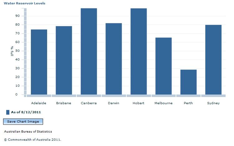
At 8 December 2011, the reservoirs in the Darwin water collection area were 81.7% full, holding approximately 233.1 GL. At the same time in 2010, these reservoirs were 77.0% full, holding 181.0 GL. Although the amount of water stored rose by 52.1 GL, or 28.8%, over the year, this increase may not be fully reflected in the 'percentage full' figure for 2011 owing to a change in the holding capacity of Darwin's reservoirs during the same period.
At 8 December 2011, the reservoirs servicing Hobart and Canberra were both near 100% capacity while Perth had the lowest reservoir levels, at 28.5% full.
Information on reservoir levels is collected, standardised and disseminated by the Bureau of Meteorology (BOM). This information includes the total volume of accessible water stored in public water storage facilities (e.g. dams) with a capacity over one gigalitre (GL) as well as the total capacity of water storage facilities in the region (% full).
For more details, including daily updates of reservoir data, go to the BOM website linked above.
Document Selection
These documents will be presented in a new window.
 Print Page
 Print All