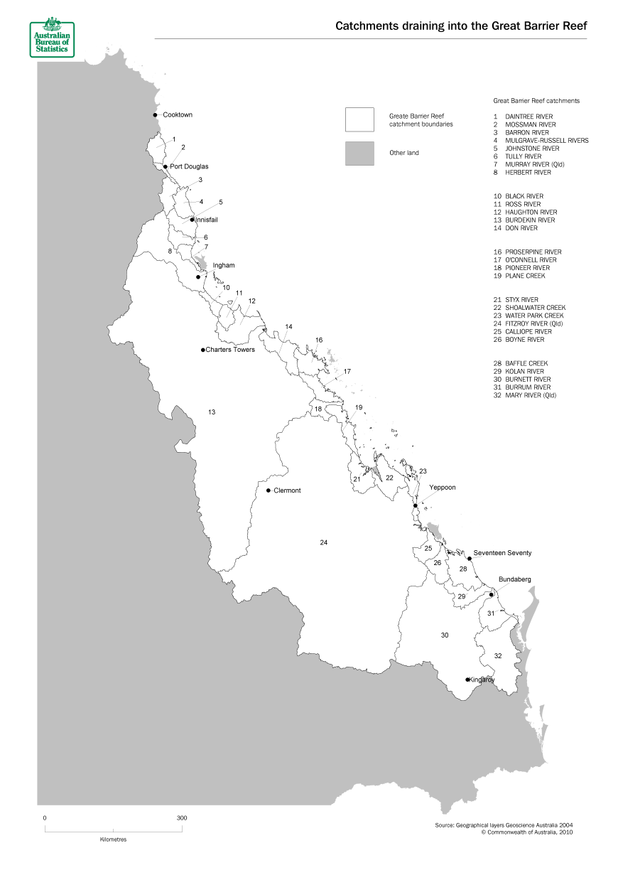
LAND IN THE GREAT BARRIER REEF CATCHMENTS
The 28 catchments draining into the Great Barrier Reef lagoon cover a total land area of over 38 million hectares across 5 Natural Resource Management (NRM) Regions. The land area covered stretches from the Wet Tropics World Heritage Area in the north to the Sunshine Coast in the south. Of this area, approximately 28.5 million hectares has been included in this survey. That is land used mainly for agricultural production by holdings with a predominant activity of sugar cane, horticulture, broadacre cropping or beef cattle grazing.
The following sections summarise key findings from the survey.
Wet Tropics NRM region
Burdekin NRM region
Mackay Whitsunday NRM region
Fitzroy NRM region
Burnett Mary NRM region
Maps
Land use maps
Data maps
 Print Page
 Print All