EXPLANATORY NOTES
INTRODUCTION
1 The Land Account: Victoria, Experimental Estimates, 2012, is a pilot project that integrates environmental, economic and social data with spatial location information. It is presented in three parts; first as a series of tables for the State of Victoria and associated Natural Resource Management (NRM) regions, an interactive spatial layer using the Google Earth® framework at the Statistical Area Level 1 (SA1) from the Australian Statistical Geography Standard (ASGS) and a socio-economic dataset also at the SA1 level that can be used in a Geographical Information System (GIS). An additional set of tables presenting change in native vegetation extent and vegetation condition will be included in a revision to this publication in early 2013.
2 Land, as an asset, represents a major proportion of Australia's national economic value and nearly all economic activities involve the use of some land. For Victoria, land was valued at $1,072.4 billion at June 2011
(Australian System of National Accounts (ASNA), 2010–11 (ABS cat. no. 5204.0)). The land assets in Australia are owned (or leased) and used by governments, businesses and individuals for a variety of purposes and activities. Administrative arrangements, such as zoning, and laws constrain the availability of land for particular purposes.
3 Land value is driven by physical characteristics such as location, vegetation cover, accessibility, climate, biodiversity, soils, mineral resources, etc. as well as other factors such as land zoning and man-made improvements applied to the land and surrounds. Areas of land with desirable characteristics attract competing demands from major land users (agriculture, industry, habitation, environmental protection, recreation). The use of land can also result in degradation or improvements to the asset; for example, mining operations commencing in native forest may destabilise natural ecosystems even though the land is usually required to be returned to its former status once the mining operations have ceased.
4 Although many sources of data are available to quantify the characteristics of land and how these characteristics change over time, the lack of integration of these data means that it has not been fully utilised to support sound decisions over the use and management of land and the associated assets. A Land Account, Australia would be part of a set of integrated environment accounts being developed by the ABS (see Towards an Integrated Environmental-Economic Account for Australia, 2010 (ABS cat. no. 4655.0.55.001)). The land accounts will be used to integrate information and could be used to inform debate on;
- population settlement;
- sustainable production of goods and services;
- understanding the costs and benefits of different land management decisions, including the impact on the carbon cycle (i.e. storage and emission of C02), water availability and water quality, species distribution and abundance;
- understanding the productive capacity of the land in mining and agricultural industries;
- measuring the health of the environment;
- understanding the economic, environmental and social costs and benefits of economic activities occurring on land; and
- public and private investment environmental protection, e.g. biodiversity conservation.
5 Production of these experimental estimates has assisted the development of the concepts and methods that will be used to produce a set of National Land Accounts. It has also been used to review the quality and limitations of the available data sources.
ENVIRONMENTAL-ECONOMIC ACCOUNTING FRAMEWORK
6 Environmental-economic accounting is a method of integrating environmental data with economic and, to a lesser degree, social data. The System of Environmental-Economic Accounting (SEEA) is an environmental-economic accounting framework developed by the United Nations Statistics Division. The SEEA Central Framework was adopted as an international statistical standard in early 2012, while a draft of the SEEA Experimental Ecosystem Accounting becomes available in November 2012.
Land Account: Victoria, Experimental Estimates, 2012 has been produced in accordance with the SEEA and will follow previous Australian Bureau of Statistics (ABS) environmental-economic accounting publications utilising this system -
Land Account: Great Barrier Reef Region, Experimental Estimates, 2011 (ABS cat. no. 4609.0.55.001),
Energy Account, Australia, 2010–11 (ABS cat. no. 4604.0) and
Water Account, Australia, 2010–11 (ABS cat. no. 4610.0).
7 For further information on environmental-economic accounting please refer to the ABS Information Papers:
Completing the Picture - Environmental Accounting in Practice, May 2012 (ABS cat. no. 4628.0.55.001),
What are Environmental Accounts?, 2008 (ABS cat. no. 4655.0.55.001),
Towards an Integrated Environmental-Economic Account for Australia, 2010 (ABS cat. no. 4655.0.55.001), and the
United Nations Statistical Division.
SCOPE, COVERAGE AND GEOGRAPHY
8 This publication is part of a set of integrated environmental-economic accounts currently being developed by the ABS. It aims to provide statistics on land to inform decision-making, research and discussion. The data is presented in a series of statistical tables as well as in a spatial format. This publication follows the structure of
Land Account: Great Barrier Reef Region, Experimental Estimates, 2011 (ABS cat. no. 4609.0.55.001).
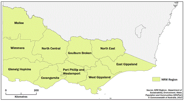
9 Figure 1 shows a map of the study region, Victoria, Australia. This release presents an experimental land account for the state of Victoria and the associated Natural Resource Management (NRM) regions: Corangamite, East Gippsland, Glenelg Hopkins, Goulburn Broken, Mallee, North Central, North East, Port Phillip and Westernport, West Gippsland and Wimmera.
Figure 1 Study region (Victoria, Australia)
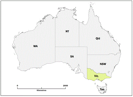
Figure 2 NRM Regions with Victoria, Australia
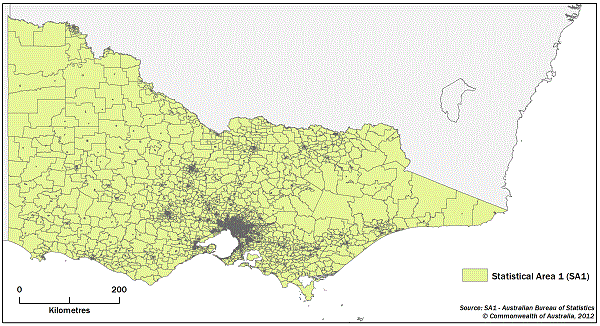
10 This publication uses the new Australian Statistical Geography Standard (ASGS), containing boundaries, labels and codes for the new Statistical Area (SA) units and capital cities. The ASGS replaced the Australian Standard Geographic Classification (ASGC) in July 2011. The ASGS Statistical Area Level 1 (SA1) has been used as the base layer for producing spatial information for this publication. There are 13,335 SA1's in Victoria (see Figure 3) with an average population of approximately 400. For further information please refer to the
ABS Statistical Geography Portal.
Figure 3. Map of SA1 boundaries in Victoria
DATA SOURCES
11 This publication was produced using information from a number of Commonwealth and State Government Departments. The ABS gratefully acknowledges the assistance provided by these agencies. The data sources are listed below:
- Cadlite®, February 2012 - Public Sector Mapping Agencies (PSMA). This spatial dataset contains land parcel and property information from across Australia and includes names of suburbs and boundary locations. It is a graphical index of digital cadastral boundaries, excluding easements and road drainage easements.
Further information is available from the PSMA web site: http://www.psma.com.au/.
- Dynamic Land Cover Mapping - Geoscience Australia (GA) in collaboration with the Australian Bureau of Agricultural and Resource Economics and Sciences (ABARES). Geoscience Australia (GA) provided a draft version of the Dynamic Land Cover Map for Australia. The Dynamic Land Cover Dataset (DLCD) of Australia is the first nationally consistent and thematically comprehensive land cover reference for Australia. It is the result of collaboration between GA and ABARES, and provides a base-line for identifying and reporting on change and trends in vegetation cover and extent.
The DLCD includes 186 snapshots of vegetation greenness for each 250m by 250m area of the country from April 2000 to April 2008. The classification scheme used to describe land cover categories in the DLCD conforms to the 2007 International Standards Organisation (ISO) land cover standard (19144-2). The DLCD shows Australia land cover clustered into 34 ISO classes. These reflect the structural character of vegetation, ranging from cultivated and managed land covers (crops and pastures) to natural land covers such as closed forest and sparse, open grasslands.
The source data for the DLCD is a time series of Enhanced Vegetation Index (EVI) data from the Moderate Resolution Imaging Spectroradiometer (MODIS) on the Terra and Aqua satellites operated by National Aeronautics and Space Administration (NASA).
ABS has now obtained an updated version of the DLCD for the Victorian Land Account. This includes the addition of a class about Built Up Areas. This represents a concentration of buildings surrounding a network of roads and supported by other associated infrastructure.
Further information is available from the GA web site http://www.ga.gov.au/.
- The State of Victoria - Land valuations file. The valuations file provides information on land use classifications and land values for cadastral properties.
- Forest Extent and Change (Version 6) - Australian Government Department of Climate Change and Energy Efficiency (DCCEE). Landsat (satellite) imagery from 1972-2009 was used to discriminate between forest and non-forest cover by measuring the forest cover in two consecutive epochs and subtracting one from the other. Further information is available from the DCCEE website: http://www.climatechange.gov.au/.
A forest is defined as vegetation with a minimum 20 per cent canopy cover, potentially reaching 2 metres high and a minimum area of 0.2 hectares. Landsat satellite imagery was used to discriminate between forest and non-forest cover. The probability of forest cover is mapped across Australia at a 25-metre resolution from Landsat imagery. Regionally appropriate thresholds are placed on these forest probabilities to create forest extent data. Differencing consecutive epochs allows the creation of both deforestation and regrowth layers. The attributed change products identify human induced change resulting in a change in the land use such as forest clearing for agricultural purposes. It does not include temporary changes to the forest such as fire.
The dataset is currently updated annually. This update involves the addition of another year of data; the re-processing of all preceding years; as well as the incorporation of methodological improvements. The Queensland Herbarium within the Queensland Government Department of Environment and Resource Management (DERM) is also acknowledged as the state custodian for vegetation information.
For further information see National Carbon Accounting System (NCAS) Technical Report No. 9 "Land Cover Change: Specifications for Remote Sensing Analysis" for details of the analytical methodology http://pandora.nla.gov.au/pan/102841/20090728-0000/www.climatechange.gov.au/ncas/reports/tech09.html or contact:
GIS Manager
National Carbon Accounting System - NCAS
Department of Climate Change & Energy Efficiency
GPO Box 854
CANBERRA ACT 2601
- Catchment Scale Land Use of Australia, March 2010 - Australian Bureau of Agricultural and Resource Economics and Sciences (ABARES). Land use mapping was used at two scales: national scale (1:2,500,000) and catchment scale (1:25,000) using the Australian Land Use and Management (ALUM) classification. Further information is available from the ABARES web site: http://www.abares.gov.au/.
- National Vegetation Information System V3 (NVIS) - Department of Sustainability, Environment, Water, Population and Communities (SEWPaC) - NVIS is a data system that contains information on the extent and distribution of vegetation types in Australian landscapes. For further background and other NVIS products, please see the links on http://www.environment.gov.au/erin/nvis/index.html.
- Transport and Topography™ - PSMA. A spatial dataset containing information on transport (including roads, railways etc), hydrology and green space. Further information is available from the PSMA web site: http://www.psma.com.au/.
- Estimated Resident Population (ERP) - Australian Bureau of Statistics. ERP's are official estimates of the Australian population, which link people to a place of usual residence within Australia. More information about ERP and other population concepts is available in Information Paper: Population Concepts, Australia, 2008 (ABS cat. no. 3107.0.55.006).
Population estimates at the SA1 level as at 30 June of a census year are complied by apportioning the population estimate for each Statistical Area Level 2 (SA2) across the SA1s within the SA2, using census usual residence counts.
Caution should be exercised when using these estimates, especially for areas with very small populations. While unrounded figures are released, accuracy to the last digit is not claimed and should not be assumed. Estimates aggregated to broader regions, and age groups, are more reliable than the finer level regional or age breakdowns.
All ERP data sources, including from the Census of Population and Housing, are subject to error. Errors can arise from inaccuracies in collecting, recording and processing the data. The ABS does not have control over any error associated with non-ABS administrative data sources, nor, to a large extent, dwelling approvals, births and deaths registrations and overseas migration data. The accuracy of some administrative data sources is also dependant on the length of time taken for migrators to update their address details with the relevant agency.
The accuracy of sub-state ERPs, including SA2 ERPs, is described in the Quality Declaration for Regional Population Growth, Australia, 2010–11 (ABS cat. no. 3218.0). The accuracy of SA1 ERPs is partly dependent on the accuracy of SA2 ERPs.
These estimates are subjected to confidentialisation and randomisation processes. Thus, all small estimates should be regarded as derived numbers rather than actual counts of the population.
- Building Approvals - Australian Bureau of Statistics - Data for building work approvals are compiled from:
- permits issued by local government authorities;
- contracts let or day labour work authorised by Commonwealth, State, semi-government and local government authorities and;
- major building activity in areas not subject to normal administrative approval (e.g. building on remote mine sites).
The data included in this profile relate to all residential building approvals valued at $10,000 or more and all approved non-residential building jobs valued at $50,000 or more.
Construction activity not defined as building (e.g. construction of roads, bridges, railways etc.) is excluded from building statistics.
The data are as at the June 2012 issue of Building Approvals, Australia, and refer to the financial year ended 30 June. For further information see Building Approvals, Australia, October 2012 (ABS cat. no. 8731.0).
DATA CURRENCY
12 The two datasets used to produce the main cross-classification tables are land valuations from the State of Victoria and Geoscience Australia's Dynamic Land Cover product. The reference periods for these data sets do not align. The Victorian valuations data represents land use and value ranging from 2011 to 2012. Dynamic Land Cover is compiled from satellite imagery collected between 2000 and 2008. The primary aim of this publication was to develop a consistent and repeatable methodology for producing regular National Land Accounts. This aim drove the selection of the primary data sets used.
METHODOLOGY
13 The following methodology describes how the data presented in the main cross-classification tables (1-3) were derived. Cross-classification tables produced for the State and each NRM region are:
- Table 1 - Land use by Land cover (rateable value), 2012 and
- Table 2 - Land use by Land cover (hectares), 2012.
A single cross-classification table was produced at the State level:
- Table 3 - Sector (Australian and New Zealand Standard Industrial Classification (ANZSIC)) by Land cover (rateable value), 2012.
14 Methodology for producing the tables;
- The PSMA CadLite property theme was used as the base layer for the Land Account. This provided land parcel and property information for Victoria. A property is a commonly owned piece of land, it can be one or many Cadastral parcels. CadLite does not cover all land in Victoria. Land not covered by CadLite property theme has been presented as ‘transport easements’ in Table 2. This land is not represented in the Victorian valuations data and therefore cannot be readily be valued. It is not presented in Table 1 or Table 3.
The two output geographies for the Victorian Land Account are NRM regions and SA1 regions from the ASGS. Each commonly owned property in Victoria was assigned an NRM and SA1 code by spatially joining these boundaries using the centroid of each property. Issues of boundary alignment existed between CadLite and the SA1 and NRM regions. Properties unable to be assigned both an SA1 and NRM code were excluded from this analysis.
- The Victorian valuations file was a primary data source. This provided information on property identifiers, land use under the Australian Valuation Property Classification Codes (AVPCC) classification and site value. These variables were used for the development of Tables 1, 2 and 3. The Victorian valuations file was provided to the ABS as a tabular table. The process of joining the valuations data to CadLite property theme required a bridge layer called VicMap Property available from: http://www.land.vic.gov.au/.
A tabular join successfully linked 82% of valuations records to properties. The remaining valuations records were linked to the CadLite property theme using address coding. Only addresses returning an accurate match to a precisely located Geocoded National Address File (GNAF) point were accepted. Following this process approximately 2% of valuation records remained unallocated to a property. These unallocated records were excluded from this analysis.
In some cases, multiple valuation records joined to a single property. Valuation information allowed for a simple split of site value between different land uses on a property. However, no reliable information was available to split land area. For the Land Account: Great Barrier Reef Region, Experimental Estimates, 2011 (ABS cat. no. 4609.0.55.001) publication, land area was attributed by dividing property area by number of valuation records. This methodology has been revised for this publication, as it did not reflect the varying sizes of different land use types. For this analysis a look-up table of average land use area (primary AVPCC codes) for all properties with a single valuation record attached was created. These averages were used to weight area within properties with multiple valuation records and different land uses.
The valuations file does not cover all land in Victoria. PSMA produces a green space theme within the Transport and Topography dataset. All polygons classified as National Parks in this dataset were extracted and overlaid on properties where no valuations data had been joined. In Table 2, the AVPCC 'National Parks, conservation areas, forest reserves and natural water reserves' class was supplemented with this information. Data from the green space theme only reflects land area, not land value. Therefore the 'National Parks, conservation areas, forest reserves and natural water reserves' land use is not comparable between Table 1 and 2.
- In the Land Account: Great Barrier Reef Region, Experimental Estimates, 2011 (ABS cat. no. 4609.0.55.001), business data was allocated to a cadastral parcel for those businesses with a registered business address in the region and an active Australian Business Number (ABN). The sector (ANZSIC) of the ABN was applied to the cadastral parcel to provide information by Sector. This methodology has not been continued for the Land Account: Victoria, Experimental Estimates, 2012 with the aim of creating an improved, repeatable dataset that can be used to show change over time.
For this publication a single State table (Table 3) presents ANZSIC industries cross-classified with the DLCD, showing rateable value of land. This table did not rely upon the ABS Business Register but instead used a concordance table based on the correlation between AVPCC land use and ANZSIC sector. Table 3 presents details by ANZSIC at the division level with the exception of Agriculture which is split into sub-divisions. Due to differences in classification between AVPCC and ANZSIC it was not possible to accurately assign all land uses to the appropriate ANZSIC division and Agriculture sub-division. For example Table 3 has no data in the ANZSIC sub-division for 'Deer Farming'. The AVPCC land use that includes deer farming also includes other livestock farming such as goats, ostriches and alpacas. This land use has been assigned to the ANZSIC Agriculture Sub-division 'Other Livestock Farming'. In addition, classes for 'Agriculture Unallocated Industry ' and 'Other Unallocated Industry' were created to assign AVPCC classes that were unable to be assigned to an existing ANZSIC class.
The AVPCC land use and ANZSIC sector concordance table was independently produced by ABS staff for the purpose of assigning land values to spatial locations within Victoria. The numbers presented in Table 3 should therefore be used with caution.
- The main cross classification tables publish data consistent with Australian System of National Accounts (ASNA), 2010–11 (ABS cat. no. 5204.0). ABS National Accounts use projected values of land from the State of Victoria for Rural and Commercial land. The value of Residential land is sourced from a method that uses a combination of data produced by the ABS and the Reserve Bank of Australia (RBA). The ABS/RBA method generates combined estimates of land and dwellings owned by households. The ABS value of dwellings owned by households is then subtracted to derive the value of residential land owned by households. As a result, raw Victorian site values do not fully align with values published in ASNA. To ensure values presented in the Victorian Land Account align with ASNA, the site values in Tables 1 and 3 were weighted to the ASNA output values for Rural, Commercial and Residential land in Victoria.
Australian System of National Accounts (ASNA), 2010–11 (ABS cat. no. 5204.0) also includes an Other land use, valued at $59.1 billion for 2011. This is non-rateable land, including; crown land, National Parks and other land owned by government, and land held under native title and other types of arrangements. The Victorian land valuations data do not incorporate non-rateable land, thus Land Account: Victoria, Experimental Estimates, 2012 represents the 2011 ASNA value minus Other land use.
In concept, Land Account: Victoria, Experimental Estimates, 2012 is consistent with the ASNA. However, there is a significant lead-time necessary to incorporate monetary estimates for the value of Victorian land into the Land Account. In the course of producing monetary estimates for this publication a later edition of the ASNA was released, Australian System of National Accounts (ASNA), 2011–12 (ABS cat. no. 5204.0). The data contained in Land Account: Victoria, Experimental Estimates, 2012 are consistent with the previous 2010–11 (Australian System of National Accounts (ASNA), 2010–11 (ABS cat. no. 5204.0)) edition of the ASNA.
- The DLCD was provided by Geoscience Australia as a 250m by 250m grid for Australia. Using ESRI ArcMap™, the DLCD was converted to a feature using the ‘raster to polygon’ function. The output of this conversion was then intersected with the CadLite Property theme. This process can create areas of Land Cover smaller than the resolution of the original grid. Any value of less than 6.25 hectares in area is less than the resolution of the DLCD and should be used with caution.
SA1 Google Earth and spatial layers
15 To produce the interactive spatial layer, a range of socioeconomic and environmental data was overlaid onto spatial boundaries at the Statistical Area 1 (SA1) level. This data was then exported into Google Earth® to present data for each SA1 in Victoria electronically. This layer has also been produced in a tab delimited text format, Mapinfo format and ESRI Geodatabase format for use in a Geographic Information System.
Cadastral boundaries do not always align exactly with SA1 boundaries. In order to transfer data from the cadastral layer the SA1 layer the centroid of each cadastral parcel was used. Sometimes this results in cadastral parcels with boundaries extending outside the SA1 they are associated with. In some rare cases this will result in the sum of cadastral parcel area being larger than the area of the SA1. This information is published in the SA1 dataset as the percentage of each SA1's area covered by cadastral parcels. Sometimes the Area of Cadastral parcels can be more than 100%. For the Victorian SA1 layer this has occurred in 461 of the 13,335 SA1s (3.4%). SA1s adjacent to these overflowing SA1s will tend to have less than 100% cadastral area.
The boundaries used in the Google Earth® file are a simplified version of the official SA1 boundaries. The official SA1 boundaries can be downloaded from
Australian Statistical Geography Standard (ASGS): Volume 1 - Main Structure and Greater Capital City Statistical Areas, July 2011 (ABS cat. no. 1270.0.55.001).
16 In the tab delimited, MapInfo and ESRI Geodatabase format files, suppressed cells have been reported as ‘0’ to maintain a numeric field format. Additional columns with ‘_np’ added to the original field name have been included to identify suppressed (np) and non-suppressed ( - ) data. These additional fields should be used in conjunction with their preceding data fields.
17 Land values reported at the SA1 level are sourced from the State of Victoria and do not align with the values used in Tables 1, 2 and 3 which align with the Australian National Accounts.
18 A detailed description of each SA1 data item can be found in Appendix 1.
Cadastral change data
19 This product is an analysis of Cadastral data from PSMA CadLite with the aim of showing change over time. By identifying subdivision of Cadastral parcels, users will be able to locate changes in settlement patterns and changes in land use. SA1 counts of Cadastral parcels were produced using the centroid of each parcel. The dates of datasets being used for this analysis are August 2002, 2006 and 2011. These dates coincide with Census' of Population and Housing with the exception of 2002 which is the earliest available PSMA Cadlite dataset. Counts were made for 7 size ranges as a proxy for the expected land uses:
- 0-0.075 ha (predominantly urban residential)
- 0.075-0.15 ha (predominantly urban residential)
- 0.15-0.4 ha (predominantly mixed uses generally in urban/built up areas)
- 0.4-2 ha (predominantly peri-urban, rural residential but will include urban industrial/commercial and parks)
- 2-10 ha (predominantly peri-urban, rural residential)
- 10-100 ha (predominantly agriculture, reserves)
- >= 100 ha (predominantly agriculture, reserves)
20 Cadastral data is sourced from PSMA's CadLite product. This data is supplied to PSMA by each State and Territory jurisdiction, and in turn each State and Territory receives data from local Governments. The currency and frequency of data delivery within this supply chain can result in anomalies in the cadastral counts. This has been largely ameliorated by comparing periods 4 and 5 years apart, however users should be aware that not all cadastral change will be the result of land development, but could be caused by historical updates to Cadastre including boundary re-alignments.
CONFIDENTIALITY
21 Where appropriate, certain data has been suppressed to prevent the release of any information that may identify any individual or organisation.
CLASSIFICATIONS
22 The following classifications were used in this publication:
- Australian Statistical Geography Standard (ASGS)
- Australian Land Use and Management (ALUM)
- Australian and New Zealand Standard Industrial Classification 2006 (ANZSIC)
- Australian Valuation Property Classification Codes (AVPCC)
- International Standards Organisation Land Cover Classification (ISO 19144-2)
- National Vegetation Information System - Information Hierarchy
RELATED PUBLICATIONS
23 Users should also refer to Land Account: Great Barrier Reef Region, Experimental Estimates, 2011 (ABS cat. no. 4609.0.55.001). The GBR Land Accounts presents the first experimental estimates produced by the ABS for Queensland. This methodology formed the basis of the
Land Account: Victoria, Experimental Estimates, 2011.
24 For further information on environmental accounting please refer to the ABS Information Paper:
Completing the Picture - Environmental Accounting in Practice, May 2012 (ABS cat. no. 4628.0.55.001),
What are Environmental Accounts?, 2008 (ABS cat. no. 4655.0.55.001) and
Towards an Integrated Environmental-Economic Account for Australia, 2010 (ABS cat. no. 4655.0.55.001).
25 The
Australian Statistical Geography Standard (ASGS) (ABS cat. no. 1270.0.55.001)is the framework for understanding and interpreting the geographical context of statistics published by the ABS. From July 2011 the ABS will progressively replace the current ASGC with the new ASGS as its geographical framework. Further information can be found at the ABS website -
https://www.abs.gov.au/.
26 Counts of active ABNs with a Registered Business Address were included in the
Land Account: Great Barrier Reef Region, Experimental Estimates, 2011 (ABS cat. no. 4609.0.55.001). This data item has been omitted from this publication as it is available from
Counts of Australian Businesses, including Entries and Exits, Jun 2007 to Jun 2011 (ABS cat. no. 8165.0).
27 Other ABS environmental-economic accounting publications which have been published in accordance with the SEEA, including;
Energy Account, Australia, 2009–10 (ABS cat. no. 4604.0) and
Water Account, Australia, 2010–11
(ABS cat. no. 4610.0).
28 Land, timber and sub-soil assets are also included on the national balance sheet contained in the
Australian System of National Accounts (ASNA), 2011–12 (ABS cat. no. 5204.0). Additionally, information on land valuation methodology used to produce the national balance sheet on land can be found in following feature article
Australian System of National Accounts, 2005–06 - Valuing land and dwellings owned by households.
29 Other ABS publications related to this topic include:
SYMBOLS USED
| np | not available for publication but included in totals where applicable, unless otherwise indicated |
| — | nil or rounded to zero (incl. null cells) |
APPENDIX 1: DETAILED DESCRIPTION OF EACH SA1 DATA ITEM.
| Theme | Table | Data item name | Abbreviated name | Unit | Description |
| Land area & land value | Land area | SA1 identifying code | SA1_MAINCODE_2011 | - | A unique 11 digit hierarchical code that identifies each SA1 region. |
| Land area & land value | Land area | Area of this SA1 | SA1_AREA_ALBERS_HA | Ha. | The area of this SA1 in hectares. |
| Land area & land value | Land area | Area of Cadastral properties | BND_CAD_PROPORTION | % | Proportion of total SA1 area covered by Cadastral properties. |
 |
| Land area & land value | Land value | Rateable value | LV_SITE_VALUE | $m | The total rateable land value in this SA1. |
| Land area & land value | Land value | Capital value | LV_CAPITAL_VALUE | $m | The total capital land value in this SA1. |
|
| Population and land development | Estimated Resident Population | ERP 2002 | ERP_2002 | No. | Estimated Resident Population 2002. |
| Population and land development | Estimated Resident Population | ERP 2006 | ERP_2006 | No. | Estimated Resident Population 2006. |
| Population and land development | Estimated Resident Population | ERP 2011 | ERP_2011 | No. | Estimated Resident Population 2011. |
|
| Population and land development | Building approvals 2011/12 | New dwellings approved | BAP_DWELL | No. | New dwelling units approved 2011/12. |
| Population and land development | Building approvals 2011/12 | Value of total building approved | BAP_VALUE | $,000 | Value of total building approved 2011/12. |
|
| Population and land development | Cadastral parcel change | 2002 - 2011 ( 0 - 0.075 ha ) | CAD_0211_1 | No. | Increase or decrease in the number of Cadastral parcels sized 0 to 0.075 hectares (0-750 m2) between Aug 2002 and Aug 2011. |
| Population and land development | Cadastral parcel change | 2002 - 2011 ( 0.075 - 0.15 ha ) | CAD_0211_2 | No. | Increase or decrease in the number of Cadastral parcels sized 0.075 to 0.15 hectares (750-1500 m2) between Aug 2002 and Aug 2011. |
| Population and land development | Cadastral parcel change | 2002 - 2011 ( 0.15 - 0.4 ha ) | CAD_0211_3 | No. | Increase or decrease in the number of Cadastral parcels sized 0.15 to 0.4 hectares between Aug 2002 and Aug 2011. |
| Population and land development | Cadastral parcel change | 2002 - 2011 ( 0.4 - 2 ha ) | CAD_0211_4 | No. | Increase or decrease in the number of Cadastral parcels sized 0.4 to 2 hectares between Aug 2002 and Aug 2011. |
| Population and land development | Cadastral parcel change | 2002 - 2011 ( 2 - 10 ha ) | CAD_0211_5 | No. | Increase or decrease in the number of Cadastral parcels sized 2 to 10 hectares between Aug 2002 and Aug 2011. |
| Population and land development | Cadastral parcel change | 2002 - 2011 ( 10 - 100 ha ) | CAD_0211_6 | No. | Increase or decrease in the number of Cadastral parcels sized 10 to 100 hectares between Aug 2002 and Aug 2011. |
| Population and land development | Cadastral parcel change | 2002 - 2011 ( >100 ha ) | CAD_0211_7 | No. | Increase or decrease in the number of Cadastral parcels sized greater than 100 hectares between Aug 2002 and Aug 2011. |
| Population and land development | Cadastral parcel change | 2006 - 2011 ( 0 - 0.075 ha ) | CAD_0611_1 | No. | Increase or decrease in the number of Cadastral parcels sized 0 to 0.075 hectares (0-750 m2) between Aug 2006 and Aug 2011. |
| Population and land development | Cadastral parcel change | 2006 - 2011 ( 0.075 - 0.15 ha ) | CAD_0611_2 | No. | Increase or decrease in the number of Cadastral parcels sized 0.075 to 0.15 hectares (750-1500 m2) between Aug 2006 and Aug 2011. |
| Population and land development | Cadastral parcel change | 2006 - 2011 ( 0.15 - 0.4 ha ) | CAD_0611_3 | No. | Increase or decrease in the number of Cadastral parcels sized 0.15 to 0.4 hectares between Aug 2006 and Aug 2011. |
| Population and land development | Cadastral parcel change | 2006 - 2011 ( 0.4 - 2 ha ) | CAD_0611_4 | No. | Increase or decrease in the number of Cadastral parcels sized 0.4 to 2 hectares between Aug 2006 and Aug 2011. |
| Population and land development | Cadastral parcel change | 2006 - 2011 ( 2 - 10 ha ) | CAD_0611_5 | No. | Increase or decrease in the number of Cadastral parcels sized 2 to 10 hectares between Aug 2006 and Aug 2011. |
| Population and land development | Cadastral parcel change | 2006 - 2011 ( 10 - 100 ha ) | CAD_0611_6 | No. | Increase or decrease in the number of Cadastral parcels sized 10 to 100 hectares between Aug 2006 and Aug 2011. |
| Population and land development | Cadastral parcel change | 2006 - 2011 ( >100 ha ) | CAD_0611_7 | No. | Increase or decrease in the number of Cadastral parcels sized greater than 100 hectares between Aug 2006 and Aug 2011. |
|
| Population and land development * | Cadastral parcel counts | 2002 ( 0 - 0.075 ha ) | CAD_02_1 | No. | Number of Cadastral parcels sized 0 to 0.075 hectares (0-750 m2) at August 2002. |
| Population and land development * | Cadastral parcel counts | 2002 ( 0.075 - 0.15 ha ) | CAD_02_2 | No. | Number of Cadastral parcels sized 0.075 to 0.15 hectares (750-1500 m2) at August 2002. |
| Population and land development * | Cadastral parcel counts | 2002 ( 0.15 - 0.4 ha ) | CAD_02_3 | No. | Number of Cadastral parcels sized 0.15 to 0.4 hectares at August 2002. |
| Population and land development * | Cadastral parcel counts | 2002 ( 0.4 - 2 ha ) | CAD_02_4 | No. | Number of Cadastral parcels sized 0.4 to 2 hectares at August 2002. |
| Population and land development * | Cadastral parcel counts | 2002 ( 2 - 10 ha ) | CAD_02_5 | No. | Number of Cadastral parcels sized 2 to 10 hectares at August 2002. |
| Population and land development * | Cadastral parcel counts | 2002 ( 10 - 100 ha ) | CAD_02_6 | No. | Number of Cadastral parcels sized 10 to 100 hectares at August 2002. |
| Population and land development * | Cadastral parcel counts | 2002 ( >100 ha ) | CAD_02_7 | No. | Number of Cadastral parcels greater than 100 hectares at August 2002. |
| Population and land development * | Cadastral parcel counts | 2006 ( 0 - 0.075 ha ) | CAD_06_1 | No. | Number of Cadastral parcels sized 0 to 0.075 hectares (0-750 m2) at August 2006. |
| Population and land development * | Cadastral parcel counts | 2006 ( 0.075 - 0.15 ha ) | CAD_06_2 | No. | Number of Cadastral parcels sized 0.075 to 0.15 hectares (750-1500 m2) at August 2006. |
| Population and land development * | Cadastral parcel counts | 2006 ( 0.15 - 0.4 ha ) | CAD_06_3 | No. | Number of Cadastral parcels sized 0.15 to 0.4 hectares at August 2006. |
| Population and land development * | Cadastral parcel counts | 2006 ( 0.4 - 2 ha ) | CAD_06_4 | No. | Number of Cadastral parcels sized 0.4 to 2 hectares at August 2006. |
| Population and land development * | Cadastral parcel counts | 2006 ( 2 - 10 ha ) | CAD_06_5 | No. | Number of Cadastral parcels sized 2 to 10 hectares at August 2006. |
| Population and land development * | Cadastral parcel counts | 2006 ( 10 - 100 ha ) | CAD_06_6 | No. | Number of Cadastral parcels sized 10 to 100 hectares at August 2006. |
| Population and land development * | Cadastral parcel counts | 2006 ( >100 ha ) | CAD_06_7 | No. | Number of Cadastral parcels greater than 100 hectares at August 2006. |
| Population and land development * | Cadastral parcel counts | 2011 ( 0 - 0.075 ha ) | CAD_11_1 | No. | Number of Cadastral parcels sized 0 to 0.075 hectares (0-750 m2) at August 2011. |
| Population and land development * | Cadastral parcel counts | 2011 ( 0.075 - 0.15 ha ) | CAD_11_2 | No. | Number of Cadastral parcels sized 0.075 to 0.15 hectares (750-1500 m2) at August 2011. |
| Population and land development * | Cadastral parcel counts | 2011 ( 0.15 - 0.4 ha ) | CAD_11_3 | No. | Number of Cadastral parcels sized 0.15 to 0.4 hectares at August 2011. |
| Population and land development * | Cadastral parcel counts | 2011 ( 0.4 - 2 ha ) | CAD_11_4 | No. | Number of Cadastral parcels sized 0.4 to 2 hectares at August 2011. |
| Population and land development * | Cadastral parcel counts | 2011 ( 2 - 10 ha ) | CAD_11_5 | No. | Number of Cadastral parcels sized 2 to 10 hectares at August 2011. |
| Population and land development * | Cadastral parcel counts | 2011 ( 10 - 100 ha ) | CAD_11_6 | No. | Number of Cadastral parcels sized 10 to 100 hectares at August 2011. |
| Population and land development * | Cadastral parcel counts | 2011 ( >100 ha ) | CAD_11_7 | No. | Number of Cadastral parcels greater than 100 hectares at August 2011. |
|
| Land use | ALUM Land Use | Conservation and Natural Environments | ALUM_CON_NAT_ENV | % | Proportion of total SA1 area classified as Conservation and Natural Environments - Land is used primarily for conservation purposes, based on the maintenance of essentially natural ecosystems already present. |
| Land use | ALUM Land Use | Production from Relatively Natural Environments | ALUM_PRD_NAT_ENV | % | Proportion of total SA1 area classified as Production from Relatively Natural Environments - Land is used mainly for primary production based on limited change to the native vegetation. |
| Land use | ALUM Land Use | Production from Dryland Agriculture and Plantations | ALUM_PRD_DRY_AG | % | Proportion of total SA1 area classified as Production from Dryland Agriculture and Plantations - Land is used mainly for primary production, based on dryland farming systems. |
| Land use | ALUM Land Use | Production from Irrigated Agriculture and Plantations | ALUM_PRD_IRR_AG | % | Proportion of total SA1 area classified as Production from Irrigated Agriculture and Plantations - Land is used mainly for primary production, based on irrigated farming. |
| Land use | ALUM Land Use | Intensive uses | ALUM_INTENSIVE | % | Proportion of total SA1 area classified as Intensive uses - Land is subject to substantial modification, generally in association with closer residential settlement, commercial or industrial uses. |
| Land use | ALUM Land Use | Water | ALUM_WATER | % | Proportion of total SA1 area classified as water - Although primarily land cover types, water features are regarded as essential to the classification. |
|
| Land cover | Change in Forest extent | Forest Extent 2008 | FOREST_EXT_2008 | % | Proportion of total SA1 area classified as Forest extent in 2008 |
| Land cover | Change in Forest extent | Forest Extent 2011 | FOREST_EXT_2011 | % | Proportion of total SA1 area classified as Forest extent in 2011 |
| Land cover | Change in Forest extent | percentage change in forest extent 2008 to 2011 | FOREST_PROP_0811 | % | Percentage change of forest extent= (100*(Forest_ext_2011-Forest_ext_2008)/Forest_ext_2008). Note: the results of this calculation is also the same as the percentage change of the area of forest extent. |
|
| Land cover | Dynamic Land Cover | Extraction Sites | DLC_EXTRACTION | % | Proportion of total SA1 area covered by Extraction sites. |
| Land cover | Dynamic Land Cover | Inland Waterbodies | DLC_INLAND_WATER | % | Proportion of total SA1 area covered by Inland Waterbodies |
| Land cover | Dynamic Land Cover | Salt Lakes | DLC_SALT_LAKES | % | Proportion of total SA1 area covered by Salt Lakes |
| Land cover | Dynamic Land Cover | Irrigated Cropping | DLC_IRR_CROPPING | % | Proportion of total SA1 area covered by Irrigated Cropping |
| Land cover | Dynamic Land Cover | Irrigated Pasture | DLC_IRR_PASTURE | % | Proportion of total SA1 area covered by Irrigated Pasture |
| Land cover | Dynamic Land Cover | Rainfed Cropping | DLC_RAINFED_CROP | % | Proportion of total SA1 area covered by Rainfed Cropping |
| Land cover | Dynamic Land Cover | Rainfed Pasture | DLC_RAINFED_PASTURE | % | Proportion of total SA1 area covered by Rainfed Pasture |
| Land cover | Dynamic Land Cover | Wetlands | DLC_WETLANDS | % | Proportion of total SA1 area covered by Wetlands |
| Land cover | Dynamic Land Cover | Alpine Grasses - Open | DLC_APL_GRASS_OPEN | % | Proportion of total SA1 area covered by Alpine Grasses - Open |
| Land cover | Dynamic Land Cover | Hummock Grasses - Open | DLC_HUM_GRASS_OPEN | % | Proportion of total SA1 area covered by Hummock Grasses - Open |
| Land cover | Dynamic Land Cover | Sedges - Open | DLC_SEDGES_OPEN | % | Proportion of total SA1 area covered by Sedges - Open |
| Land cover | Dynamic Land Cover | Tussock Grasses - Open | DLC_TUSS_GRASS_OPEN | % | Proportion of total SA1 area covered by Tussock Grasses - Open |
| Land cover | Dynamic Land Cover | Hummock Grasses - Sparse | DLC_HUMM_SPARSE | % | Proportion of total SA1 area covered by Hummock Grasses - Sparse |
| Land cover | Dynamic Land Cover | Tussock Grasses - Sparse | DLC_TUSS_GRSS_SPAR | % | Proportion of total SA1 area covered by Tussock Grasses - Sparse |
| Land cover | Dynamic Land Cover | Shrubs - Closed | DLC_SHRUBS_CLOSED | % | Proportion of total SA1 area covered by Shrubs - Closed |
| Land cover | Dynamic Land Cover | Shrubs - Open | DLC_SHRUBS_OPEN | % | Proportion of total SA1 area covered by Shrubs - Open |
| Land cover | Dynamic Land Cover | Chenopod Shrubs - Open | DLC_CHEN_OPEN | % | Proportion of total SA1 area covered by Chenopod Shrubs - Open |
| Land cover | Dynamic Land Cover | Shrubs - Scattered | DLC_SHRUB_SCAT | % | Proportion of total SA1 area covered by Shrubs - Scattered |
| Land cover | Dynamic Land Cover | Shrubs - Sparse | DLC_SHRUB_SPARSE | % | Proportion of total SA1 area covered by Shrubs - Sparse |
| Land cover | Dynamic Land Cover | Chenopod Shrubs - Sparse | DLC_CHEN_SPARSE | % | Proportion of total SA1 area covered by Chenopod Shrubs - Sparse |
| Land cover | Dynamic Land Cover | Trees - Closed | DLC_TREES_CLOSED | % | Proportion of total SA1 area covered by Trees - Closed |
| Land cover | Dynamic Land Cover | Trees - Open | DLC_TREES_OPEN | % | Proportion of total SA1 area covered by Trees - Open |
| Land cover | Dynamic Land Cover | Trees - Scattered | DLC_TREES_SCAT | % | Proportion of total SA1 area covered by Trees - Scattered |
| Land cover | Dynamic Land Cover | Trees - Sparse | DLC_TREES_SPARSE | % | Proportion of total SA1 area covered by Trees - Sparse |
| Land cover | Dynamic Land Cover | Built Up Areas | DLC_BUILT_UP_AREAS | % | Proportion of total SA1 area covered by Built Up Areas |
| Land cover | Dynamic Land Cover | Unallocated | DLC_UNALLOCATED | % | Proportion of total SA1 area that was unable to be classified with Dynamic land cover raster data. |
* These columns are not included in the Google Earth (KML) view of the SA1 data.
 Print Page
 Print All