2011 CENSUS GEOGRAPHIC HIERARCHY
The diagram below depicts the output geographies for the 2011 Census of Population and Housing:
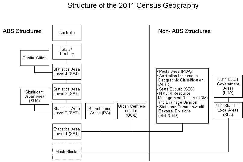
Note: Capital cities are subject to change and there will be further consultation in March/April 2010.
The Statistical Area Level 1 (SA1) unit has been designed to be the lowest level of geography for which most census data will be available. It is a slightly smaller and more consistent sized unit than the Collection District (CD). The SA1 will be designed with a population of around 400 persons for urban areas and 300 persons for rural areas. There will be approximately 55,000 SA1s for the 2011 Census compared to approximately 39,000 CDs for the 2006 Census.
The ASGC used in previous censuses produced anomalies when producing statistics for some geographic areas as CDs were primarily designed for the purpose of collecting Census data and not for disseminating it. The new ASGS was designed to produce high quality statistics and will provide either comparable or better quality statistics for most Census geographies. The SA1 unit has been designed specifically for output and should more accurately reflect the regions it is designed to represent.
There will be an intercensal review of the non-ABS structures in the lead up to the 2016 Census.
 Print Page
 Print All